


Cornwall 1 Voting District, Litchfield County, Connecticut
About
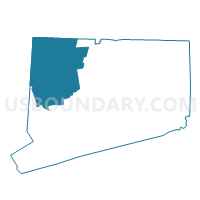
Outline

Summary
| Unique Area Identifier | 549848 |
| Name | Cornwall 1 Voting District |
| County | Litchfield County |
| State | Connecticut |
| Area (square miles) | 46.31 |
| Land Area (square miles) | 46.06 |
| Water Area (square miles) | 0.25 |
| % of Land Area | 99.45 |
| % of Water Area | 0.55 |
| Latitude of the Internal Point | 41.84964850 |
| Longtitude of the Internal Point | -73.33009490 |
Maps


Graphs
Select a template below for downloading or customizing gragh for Cornwall 1 Voting District, Litchfield County, Connecticut


Neighbors
Neighoring Voting District (by Name) Neighboring Voting District on the Map
- Canaan 1 Voting District, Litchfield County, CT
- Goshen 1 Voting District, Litchfield County, CT
- Kent 1 Voting District, Litchfield County, CT
- Norfolk 1 Voting District, Litchfield County, CT
- Salisbury 1 Voting District, Litchfield County, CT
- Sharon 1 Voting District, Litchfield County, CT
- Warren 1 Voting District, Litchfield County, CT
Top 10 Neighboring County Subdivision (by Population) Neighboring County Subdivision on the Map
- Salisbury town, Litchfield County, CT (3,741)
- Kent town, Litchfield County, CT (2,979)
- Goshen town, Litchfield County, CT (2,976)
- Sharon town, Litchfield County, CT (2,782)
- Norfolk town, Litchfield County, CT (1,709)
- Warren town, Litchfield County, CT (1,461)
- Cornwall town, Litchfield County, CT (1,420)
- Canaan town, Litchfield County, CT (1,234)
Top 10 Neighboring Elementary School District (by Population) Neighboring Elementary School District on the Map
- Salisbury School District, CT (3,741)
- Kent School District, CT (2,979)
- Sharon School District, CT (2,782)
- Norfolk School District, CT (1,709)
- Cornwall School District, CT (1,420)
- Canaan School District, CT (1,234)
Top 10 Neighboring Secondary School District (by Population) Neighboring Secondary School District on the Map
Top 10 Neighboring Unified School District (by Population) Neighboring Unified School District on the Map
Top 10 Neighboring State Legislative District Lower Chamber (by Population) Neighboring State Legislative District Lower Chamber on the Map
- State House District 64, CT (23,750)
- State House District 63, CT (23,733)
- State House District 66, CT (23,493)
- State House District 108, CT (22,451)
Top 10 Neighboring State Legislative District Upper Chamber (by Population) Neighboring State Legislative District Upper Chamber on the Map
Top 10 Neighboring 111th Congressional District (by Population) Neighboring 111th Congressional District on the Map
Top 10 Neighboring Census Tract (by Population) Neighboring Census Tract on the Map
- Census Tract 2611, Litchfield County, CT (3,741)
- Census Tract 2661, Litchfield County, CT (2,979)
- Census Tract 2961, Litchfield County, CT (2,976)
- Census Tract 4256, Litchfield County, CT (2,943)
- Census Tract 2621, Litchfield County, CT (2,782)
- Census Tract 2651, Litchfield County, CT (1,461)
- Census Tract 2632, Litchfield County, CT (1,420)
Top 10 Neighboring 5-Digit ZIP Code Tabulation Area (by Population) Neighboring 5-Digit ZIP Code Tabulation Area on the Map
- 06759, CT (5,720)
- 06756, CT (2,853)
- 06757, CT (2,258)
- 06058, CT (1,787)
- 06754, CT (1,699)
- 06031, CT (1,287)
- 06796, CT (1,009)